 City of Sunny Isles Beach Official Website
By Christopher J. Russo, Former City Manager
(April 1, 2016)
Comprehensive Planning in a Redeveloping Environment
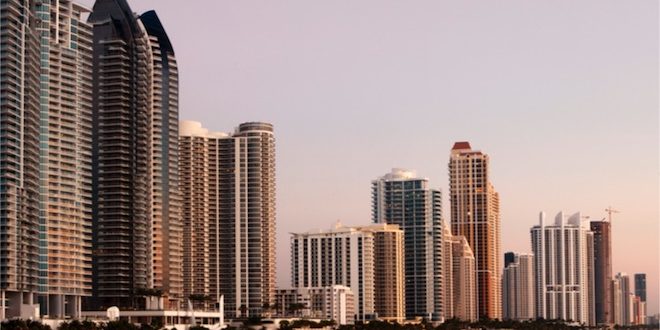
The most challenging and difficult type of development in any municipality is redevelopment. Redevelopment, by its definition, involves removing what is existing, usually antiquated and somewhat blighted structures in designated areas, in order to create a safer, and overall better quality of life for the residents. Redevelopment, through comprehensive planning was one of the primary goals in creating the City of Sunny Isles Beach in 1997. The result has been world class parks, high property values with a low tax rate, quality programs and events, and top rated Schools. The latest planning initiatives, discussed in this article, focus predominantly on the tough challenges of traffic and transportation issues.
Periodic Evaluation of Comprehensive Plan
The City of Sunny Isles Beach recently completed and submitted to the State an update of our Comprehensive Plan, which is conducted every seven years to determine compliance with our goals, objectives, and policies. This process is to review the existing plan and make recommendations based on updated data and analysis related to population growth, number of housing units, transportation, changes in parkland and open space, etc. Through our professional staff and consultants, assisted by the City Manager’s informal fact nding committee, and Town Hall type meetings, findings were presented to the public and elected officials. Once the City Commission approved these findings, brought forth as amendments to the plan, the report was submitted to the State.
Corridor Traffic Analysis Study
A Corridor Traffic Analysis Study for Collins Avenue and other roadway segments within the City was prepared. The scope of the project was to analyze current and future levels of service on various intersections. This Study evaluated these intersections by using regional traffic data and taking certain traffic counts from within the City boundary. Intersections were analyzed to establish current and future levels of capacity using standard industry measurements. Another task was to research Committed Development/Background Growth. Meaning, how will the new approved developments impact traffic and intersections. Again, all of these projections are predicated upon industry standards. The corridor analysis has been incorporated into the findings of the Transportation Master Plan.
Transportation Master Plan
This study investigated the existing and future conditions of the transportation system within the City. It includes the roadway network, the transit system, the pedestrian and bicycle network and parking system. It was intended to determine how each function interacts with the existing and future land uses, and how it can be improved to enhance mobility in the City. This was completed by examining the existing transportation conditions in the City, by looking at roadway, transit and non-motorized levels of service today, and in two planning horizons (short and long range). The Fact Finding Committee and general public assisted in the generation of transportation solutions through the Town Hall meetings. A list of potential projects, although still in need of refinement, was generated. The City staff has prioritized the actionable recommendations in the study. I am pleased to report that the City, in its efforts to be proactive, has already taken action on 17 recommendations of the 38 actionable recommendations proposed in the study. For example, the pedestrian/bike connection between Heritage Park and the Golden Shores neighborhood, and the pedestrian overpass bridges proposed for Collins Ave. To implement the significant traffic improvement projects in the Plan we need to have both funding sources identified and regional strategies (State and County) approved. The full report can be viewed on the City website at sibfl.net.